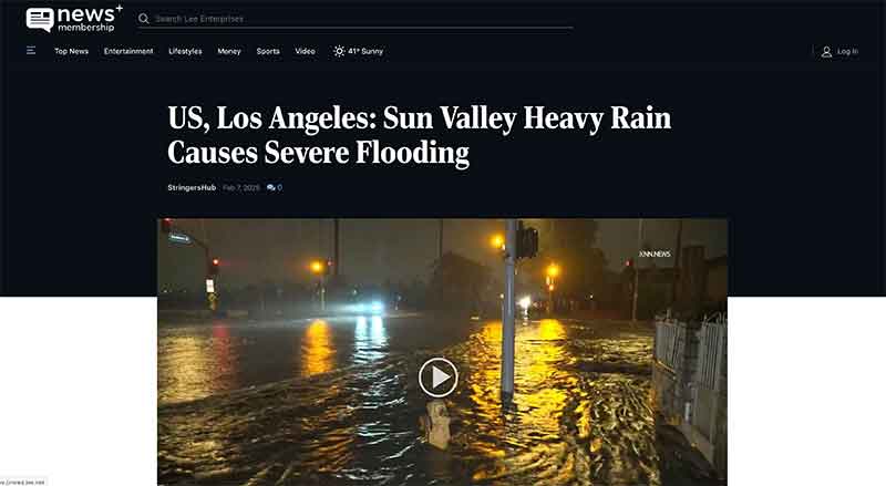
Jose Mier of Sun Valley, CA is part of the vast expanse that makes up greater Los Angeles. Current conditions call for more rain and flooding is always a factor.
Los Angeles, known for its sunny skies and dry climate, can face significant challenges when it rains. While the city may not experience flooding as frequently as other regions, it is certainly not immune to the risks. Flash floods, urban flooding, and the inundation of waterways can cause considerable damage, disrupt daily life, and pose safety hazards. Given its large urban landscape, diverse geography, and population density, Los Angeles has developed a number of strategies and infrastructure systems to mitigate and manage flooding. In this article, we’ll explore how Los Angeles deals with flooding, from its stormwater management systems to emergency preparedness, and the ongoing challenges the city faces as climate change reshapes its weather patterns.
1. Los Angeles’ Geography and Climate: The Challenge of Rainfall
Before delving into the city’s strategies for flood management, it’s essential to understand the geographical and climatic factors that contribute to flooding risks. Los Angeles is located in a semi-arid region with long periods of dry weather, receiving relatively little annual rainfall, especially compared to other parts of the U.S. The average annual rainfall in Los Angeles is around 15 inches, with the bulk of precipitation occurring in the winter months, from November to March.
When rain does fall, it can come in intense bursts, particularly during storms such as those caused by the El Niño phenomenon or atmospheric rivers. Because of the city’s geographic features—mountain ranges to the north and a coastal plain to the south—rainwater rapidly flows off the land, with little time to be absorbed into the ground. When the ground is dry or already saturated from previous storms, rainwater quickly accumulates, leading to runoff that can overwhelm the city’s storm drainage systems.
Additionally, much of Los Angeles is covered in impervious surfaces—such as roads, parking lots, and buildings—which reduce the ability of the ground to absorb rainwater, exacerbating flood risks. When heavy rainfall occurs, the city’s infrastructure is often tested to its limits.
2. Los Angeles Stormwater Management: Infrastructure and Systems
One of the most critical aspects of flood prevention in Los Angeles is its stormwater management system. Over the years, the city has built an extensive network of storm drains, channels, and flood control channels designed to move water efficiently through urban areas and reduce the risk of flooding. However, these systems face limitations due to the city’s vast size, complex geography, and aging infrastructure.
Storm Drains and Flood Control Channels
The city’s stormwater drainage system includes a vast network of catch basins, underground pipes, and surface-level drains that collect rainwater from streets and direct it to larger storm channels or rivers. Los Angeles County, through the Los Angeles County Flood Control District (LACFCD), maintains a series of concrete channels that help guide rainwater away from densely populated areas, including the Los Angeles River and the Arroyo Seco. These flood control channels, while effective in some cases, are also an area of concern. They were originally built with an emphasis on quick, efficient water diversion, but their rigid, concrete-lined design limits natural absorption and reduces their ability to support local ecosystems.
During storms, the water collected in the storm drains often flows into these channels, which direct it to the Pacific Ocean, bypassing the ground and preventing natural replenishment of aquifers. The city’s reliance on this infrastructure, which prioritizes flood control, means that Los Angeles often misses opportunities to capture and store rainwater for future use in a more sustainable way.
Retention Basins and Detention Ponds
In addition to the storm drains, Los Angeles has created retention basins and detention ponds throughout the city. These structures are designed to temporarily hold excess stormwater to prevent downstream flooding, allowing water to slowly be released into natural waterways or to evaporate. These ponds and basins are particularly important in areas prone to flash floods, where the rapid accumulation of rainwater can overwhelm smaller drainage systems.
Retention basins also serve a secondary purpose: They help manage water quality by filtering stormwater before it reaches rivers and the ocean, where pollutants like oil, chemicals, and trash may be carried. Although these basins are effective at controlling floods, they require regular maintenance and monitoring to ensure that debris, vegetation, and sediment do not hinder their functionality.
Pumps and Sump Systems
In areas where stormwater cannot naturally flow downhill into channels or basins, Los Angeles has installed pump stations and sump systems. These pumps help move water from low-lying areas and direct it toward the larger flood control systems or basins. Pumps are especially crucial in areas like downtown Los Angeles, where infrastructure is older and water can accumulate quickly during storms.
While the use of pumps helps to reduce flood risks, they also present a challenge when severe storms overwhelm the system. Power outages, equipment failure, or insufficient pump capacity during an extreme weather event can lead to localized flooding, highlighting the need for backup systems and more modern infrastructure.
3. Preparedness and Response: How Los Angeles Handles Flood Events
In addition to its physical infrastructure, Los Angeles has a number of emergency preparedness systems designed to keep residents safe during flooding events. These systems are overseen by local government agencies, including the Los Angeles Emergency Management Department (EMD), the Los Angeles Fire Department (LAFD), and the Department of Public Works.
Flood Alerts and Warnings
Los Angeles residents receive flood warnings through a combination of sources, including the National Weather Service (NWS) and the Los Angeles County Department of Public Works. When heavy rain is expected, these agencies issue advisories and warnings to inform the public of potential flooding. Alerts can include information about flash flood warnings, evacuations, and road closures. Local news stations, as well as emergency management apps, provide real-time updates on conditions, helping residents stay informed.
Evacuations and Sheltering
During extreme weather events that may lead to flooding, local government agencies are prepared to issue evacuation orders to areas most at risk. In the case of flash floods or impending mudslides, these evacuations are carried out swiftly, with emergency responders directing people to safe locations. Temporary shelters are established for displaced residents, and city officials work with law enforcement to ensure that roads are closed, and people are kept out of dangerous areas.
Community Preparedness Programs
The city also promotes community awareness and preparedness through public education initiatives. Los Angeles encourages residents to have an emergency kit, prepare for power outages, and know the flood risks in their area. In flood-prone areas, residents are urged to elevate their homes, use sump pumps, and create defensible spaces against floodwaters.
4. Ongoing Challenges: Aging Infrastructure and Urbanization
Despite the comprehensive flood control systems in place, Los Angeles faces several challenges when it comes to dealing with flooding. The city’s population continues to grow, and urbanization puts additional strain on existing infrastructure. The more buildings, roads, and parking lots are constructed, the less land there is for rainwater to be absorbed naturally. Additionally, older infrastructure may not be able to handle the intensity or frequency of storms predicted by climate change.
The 2009–2010 El Niño storm season, for example, saw heavy rains that overwhelmed local drainage systems, leading to street flooding, mudslides, and damage to homes. In many parts of the city, outdated stormwater infrastructure exacerbated the problem. Without significant upgrades to the drainage systems and a shift toward more sustainable water management practices, Los Angeles may continue to face significant risks from future flooding events.
5. Solutions for the Future: Green Infrastructure and Climate Adaptation
As Los Angeles continues to grow and climate change alters weather patterns, the city is exploring new strategies for flood prevention and water management. These strategies include the implementation of green infrastructure projects, which use natural systems such as wetlands, bioswales, and green roofs to absorb and manage rainwater more effectively.
The Los Angeles River Revitalization Plan is one example of a major initiative that focuses on improving flood control while also creating sustainable, green spaces. The project aims to restore parts of the river to a more natural state, reduce flood risks, and provide recreational areas for the public. Similarly, the city is working on capturing and reusing stormwater to alleviate some of the pressure on the traditional drainage systems.
Conclusion: A Comprehensive Approach to Flood Control
Flooding in Los Angeles is a serious concern, but through the use of comprehensive stormwater management infrastructure, emergency preparedness, and public education, the city is better equipped to handle these challenges. While the city has made significant strides in flood control, continued investment in both traditional and green infrastructure will be essential to ensure that Los Angeles remains resilient in the face of future storms. As the city adapts to a changing climate, its ability to manage floods effectively will be crucial to safeguarding both its residents and its environment.